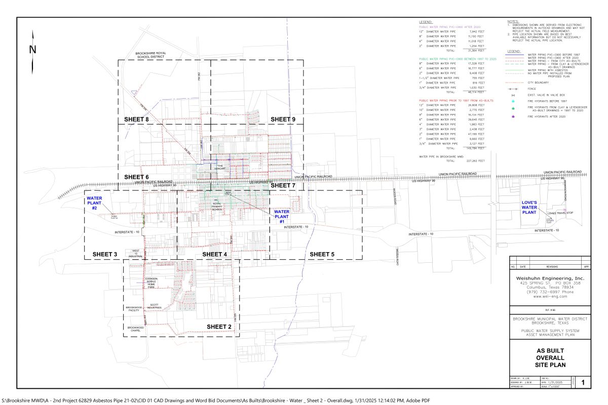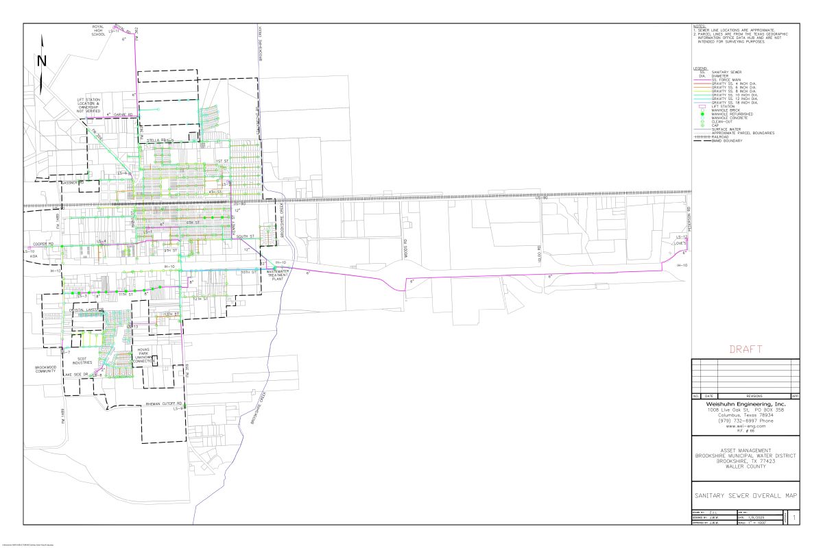

Disclaimer: Maps posted on the District’s website are for information purposes only and are not to be used for legal, engineer, or surveying purposes. It does not represent an on the ground survey and shows only approximate relative location of property boundaries and other feathers.
Need Map Help?
Contact Us: Clerk5@Brookshiremwd1.org or Call: (281) 375-5010